By Rich McKay
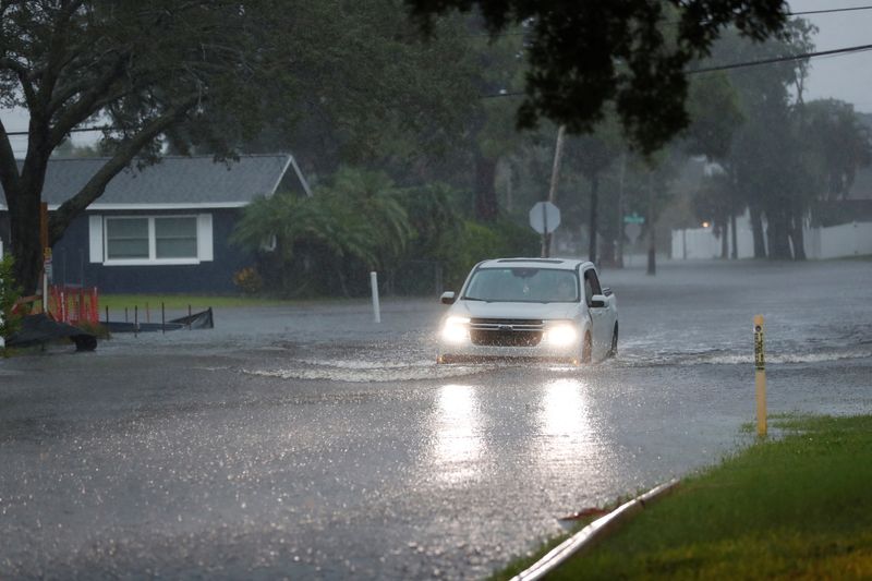
(Reuters) – Hurricane Debby is expected to slam into the Big Bend region of Florida’s Gulf Coast by midday on Monday before slowly crossing the state, causing potentially dangerous storm surges and catastrophic flooding, the National Hurricane Center (NHC) said.
By 11 p.m. EDT (0300 GMT) on Sunday, the hurricane had sustained winds of 75 mph (120 kph), growing from a slow moving tropical storm that gained strength from warm Gulf waters. It will likely just get stronger.
The hurricane center forecast life-threatening conditions, including storm surges up to 10 feet (3 meters) in some areas.
As it slowly moved north, the storm could bring “potentially historic rainfall” of between 10 and 20 inches (25 and 50 cm) and catastrophic flooding to Georgia and South Carolina, it said. Local areas could receive 30 inches of rain by Friday morning.
“This is going to be the story of this storm,” said Jamie Rhome, the deputy director of the hurricane center. “It’s slow motion is going to dump historic amounts of rainfall – potentially over 20 inches. You’re talking about catastrophic flooding.”
The storm bears some of the hallmarks of Hurricane Harvey, which hit Corpus Christi, Texas, in August 2017. While downgraded into a tropical storm as it moved inland, it lingered over the state, dumping about 50 inches of rain on Houston.
Harvey is rated as one of the wettest storms in U.S. history, causing more than 100 deaths and $125 billion in damage, primarily from flooding in the Houston metropolitan area.
Rhome said Debby was fueled by exceptionally warm Gulf waters.
Climate scientists believe man-made global warming from burning fossil fuels has raised the temperature of the oceans, making storms bigger and more devastating.
Preparing for Debby, Florida Governor Ron DeSantis called up 3,000 National Guard troops and placed most of the state’s cities and counties under emergency orders, while mandatory evacuations were ordered in parts of the Gulf Coast counties of Citrus, Dixie, Franklin, Levy and Wakulla.
DeSantis said there were more than 17,000 linemen and other electric workers ready to restore power.
The governors of Georgia and South Carolina also declared states of emergency ahead of the storm.
HEAVY RAIN
Debby became a tropical storm late on Saturday after pushing off north Cuba. As of 11 p.m. EDT, the hurricane was about 100 miles west of Tampa and moving toward the Gulf Coast at 12 mph (19 kph), with maximum sustained winds of 75 mph (120 kph), the NHC said.
The eye of Debby would move across the eastern Gulf of Mexico and reach the Florida Big Bend coast by midday on Monday, the hurricane center added. Debby was then expected to move slowly across northern Florida and southern Georgia on Monday and Tuesday, it said.
The storm is expected to lose some strength after landfall but bring heavy rain as it crosses central Florida out to the Atlantic coast, before crawling up to Savannah, Georgia, and then onward to Charleston, South Carolina, this week, lingering while dumping catastrophic amounts of rain.
Storm surges forecast for Bonita Beach northward to Tampa Bay could send sea waves further inland than normal, damaging structures and endangering anyone in their path.
The last hurricane to make a direct hit on the Big Bend region was Hurricane Idalia, which briefly gained Category 4 strength before making landfall as a Category 3 in August 2023, with winds of more than 125 mph. The National Centers for Environmental Information estimates there were $3.5 billion in damages.

Forecasters expect a large number of Atlantic hurricanes in the 2024 season, which began on June 1, with four to seven seen as major. That exceeds the record-breaking 2005 season that spawned the devastating Katrina and Rita hurricanes.
Only one hurricane, Beryl, has yet formed in the Atlantic this year. The earliest Category 5 storm on record, it struck the Caribbean and Mexico’s Yucatan peninsula before rolling up the Gulf Coast of Texas as a Category 1 storm, with sustained winds up to 95 mph.
This post is originally published on INVESTING.


